18/02/2026
El Forat de Bernia: One of the Most Spectacular Landscapes on the Costa Blanca
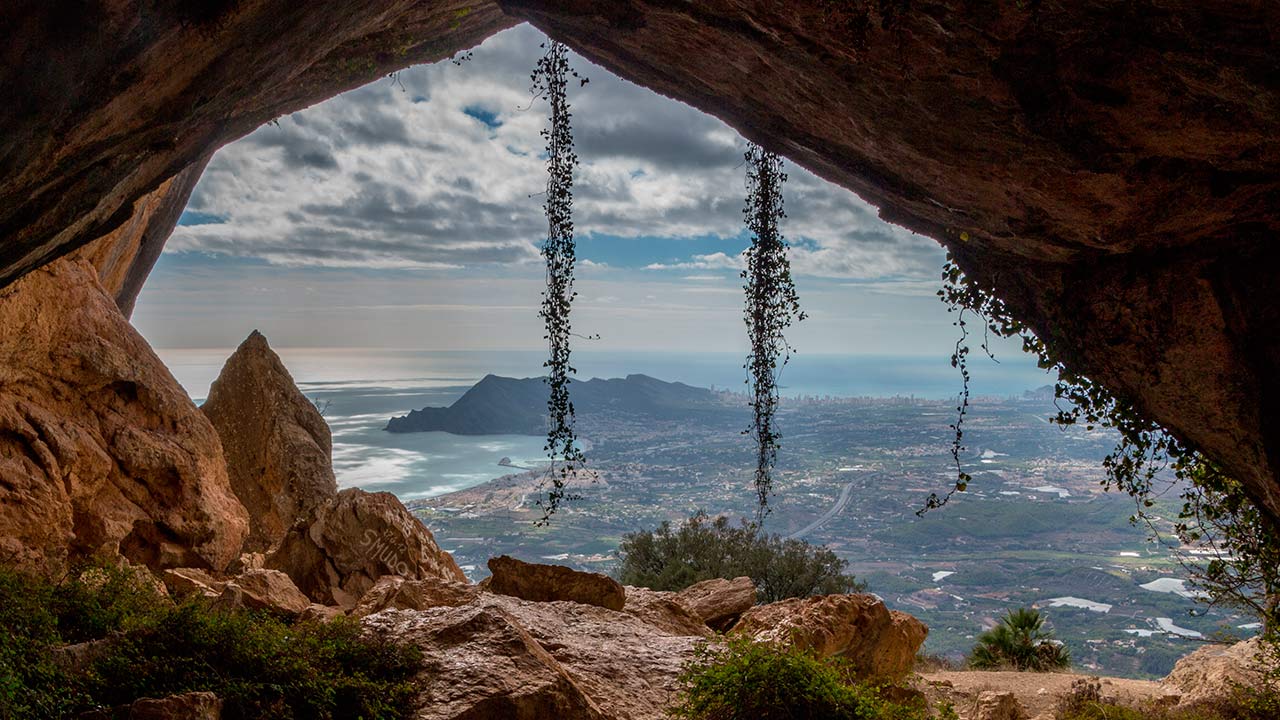
El Forat de Bèrnia has become a must-do hiking route for walkers and nature lovers visiting the province of Alicante. “Forat” means “hole” in Valencian language, and this remarkable natural arch – approximately 20 metres high – cuts dramatically through the rocky ridge of the Sierra de Bèrnia, forming a tunnel that connects the north and south faces of the mountain in just a few steps.
It is one of the most impressive natural landmarks on the Costa Blanca, offering sweeping Mediterranean views that stretch from the iconic Peñón de Ifach in Calpe to the skyline of Benidorm, passing over Altea and the entire Marina coastline.
Where Is El Forat de Bèrnia?
The Forat de Bèrnia is located in the Sierra de Bèrnia mountain range, within the municipality of Jalón, in the province of Alicante. It is primarily accessed from Benissa, either via the AP-7 motorway or the N-332 road, if coming from the coast.
How to Reach the Route?
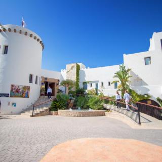
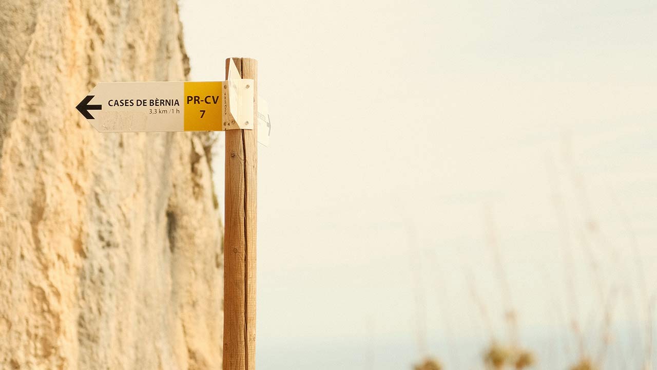
The most common starting point is the Casas de Bèrnia area, within the municipality of Benissa. Here you will find a small car park next to the information panel for the PR-CV 7 footpath, which clearly signposts the circular route.
Please note:
- The access road becomes narrow and winding towards the end, so careful driving is essential.
- Parking spaces are limited, especially at weekends and on public holidays.
- During peak periods, it is advisable to arrive before 9:00 am to secure a space.
The History and Geology of El Forat de Bèrnia
The Sierra de Bèrnia is a limestone mountain formation shaped by tectonic activity and erosion over millions of years. Its dramatic ridges, cliffs and rocky outcrops create one of the most striking landscapes in the Alicante region.
El Forat is a natural opening through the mountain ridge and is now one of the most recognisable features of the entire route.
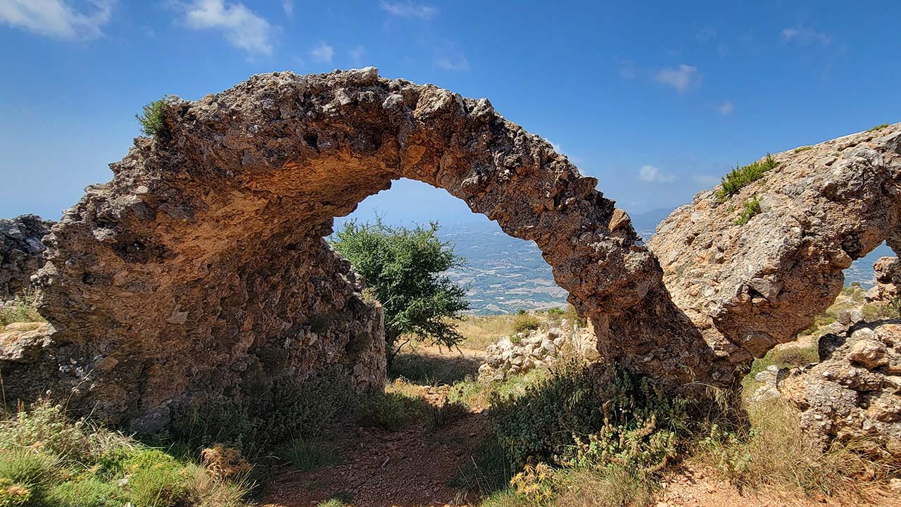
Very close to the tunnel are the remains of the Fort de Bèrnia, built in 1562 by order of Philip II of Spain. The fortress was constructed to defend the coastline against frequent Barbary pirate attacks.
Although its military use was relatively short-lived and it was abandoned just a few years later, parts of the walls and structure remain visible today. From this vantage point, visitors can enjoy panoramic views over both the coastline and the inland valleys, while imagining the strategic importance the site once held.
The Two Main Routes to Reach the Summit
1. The Classic Circular Route from Casas de Bèrnia
This is the most recommended option for a first visit.
The route begins at the car park and gradually ascends along a well-marked mountain path towards El Forat. After passing through the tunnel, walkers are rewarded with spectacular coastal views.
- Difficulty: Moderate
- Duration: Approximately 3–4 hours (depending on pace and stops)
- Type: Circular mountain route
- It is suitable for anyone with a basic level of fitness, though caution is required due to uneven terrain.
2. The Northern Slope Alternative Route
There is also a less frequented option via the northern side of the mountain. Access is by a narrower, more winding road leading to the starting point.
This alternative is ideal for those who have already completed the classic route or are seeking a different perspective of the landscape.
In both cases, this is a mountain hike and requires appropriate footwear, a reasonable fitness level and sensible precautions.
Practical Tips for Enjoying the Route
- Bring plenty of water, as much of the trail offers little shade.
- Wear proper hiking boots with good grip, as parts of the path include loose stones and rocky sections.
- The route is not particularly suitable for very young children unless they are accustomed to mountain walking.
- In summer, avoid the central hours of the day due to high temperatures.
- Arrive early at weekends to secure parking.
- After the hike, enjoy lunch at one of the nearby local restaurants to round off the experience.